
: failed to open stream: Invalid argument in <b>/home/servuzmq/minisites/siteT1/common/template/carteV2.php</b> on line <b>139</b><br />
)
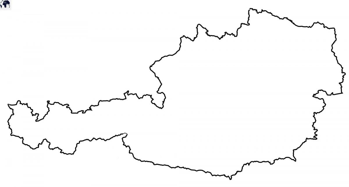
You can find on this page the blank map of Austria to print and to download in PDF. The contours map of Austria presents the international boundary of Austria in Western Europe. You can use the vector map of Austria for personal or educational use.
The blank map of Austria shows the country Austria empty. This blank map of Austria will allow you to use the map for personal activities or educational with children for example (drawing). The empty map of Austria is downloadable in PDF, printable and free.
The land-locked country of Austria has some forest degradation caused by both air and soil pollution as its mentioned in the Blank map of Austria. The soil pollution is a result of the use of agricultural chemicals. The air pollution results from emissions by coal- and oil-fired power stations, and industrial plants. Because Austria is strategically located at the crossroads of central Europe, it is also receives air pollution from the trucks transiting between northern and southern Europe.
Officially known as the Republic of Austria, it is a beautiful landlocked East Alpine country located in Central Europe. Austria is one of the most famous European countries where tourists visit in large number. Its land boundaries are about 2,562 km. Germany 784 km, Italy 430 km, Hungary 366 km, Czech Republic 362 km, Slovenia 330 km, Switzerland 164 km, Slovakia 91 km, Liechtenstein 35 km as you can see in the Blank map of Austria.
Austria Locations as its shown in the Blank map of Austria: Achensee, Alpen, Attersee, Bodensee (Lake Constance), Donau (Danube River), Drava River, Enns River, Inn River, Isar River, Karwendel Alpen, Lech River, Lechtaler Alpen, Millstatter See, Mondsee, Mur River, Neusiedler See, Ossiacher See, Raab River, Salzach River, Stubaier, The Alps, Thaya River, Traun River, Traunsee, Wolfgangsee, Worther See and Zillertaler Alpen.
The Austria map outline shows all the contours and international boundary of Austria. This outline map of Austria will allow you to easily learn about neighboring countries of Austria in Western Europe. The Austria contours map is downloadable in PDF, printable and free.
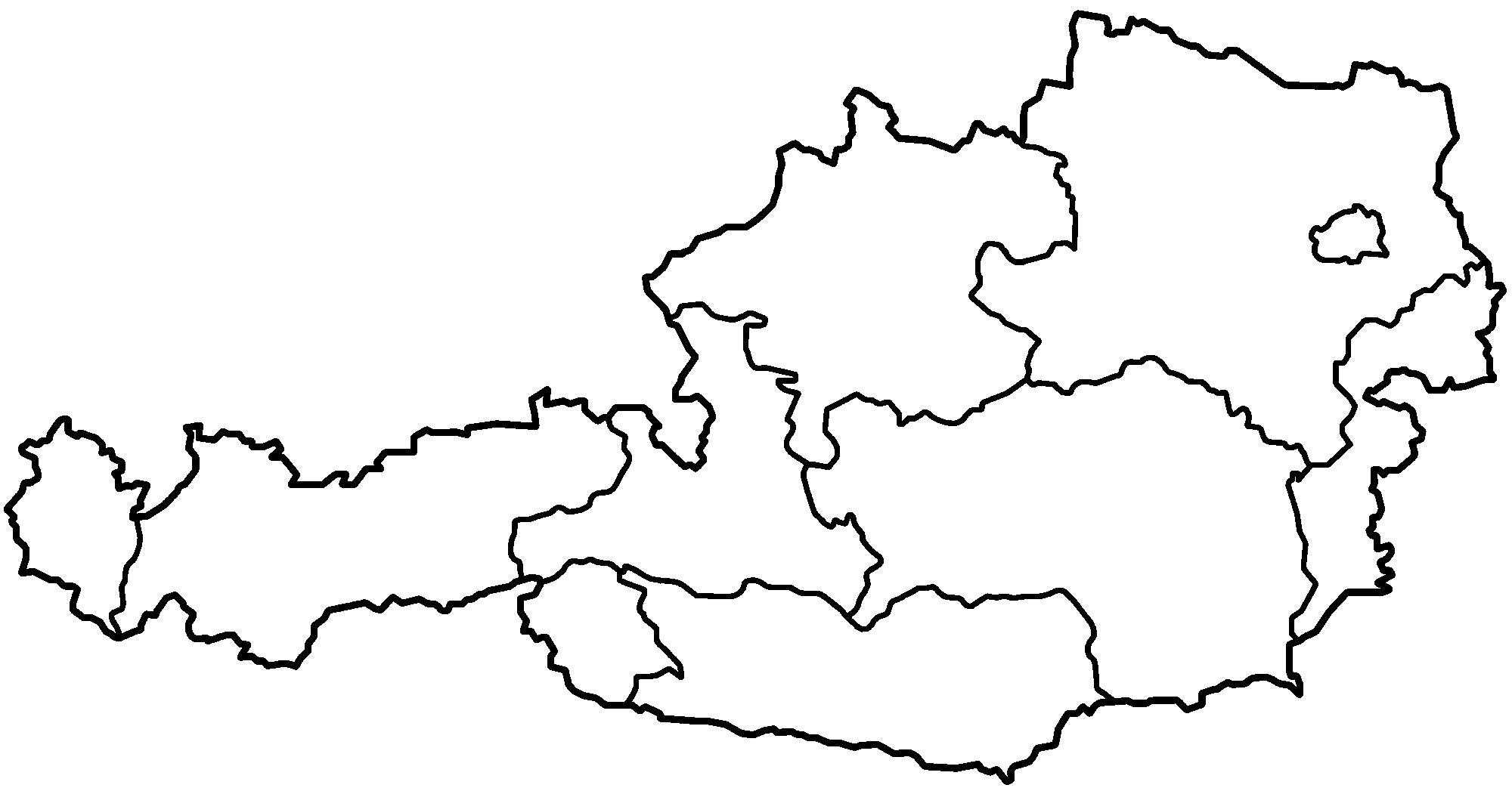
Austria (officially, the Republic of Austria) is divided into 9 federated states (Bundeslander) as you can see in Austria map outlines. In alphabetical order, the states are: Burgenland, Carinthia, Lower Austria, Salzburg, Styria, Tyrol, Upper Austria, Vienna and Vorarlberg. These states are further subdivided into a total of 94 districts of which, 79 are district commissions and 15 are statutory cities. Located in the north eastern part of the country, Vienna – is the capital, the largest and the most populous city of Austria. It is also the administrative, cultural and economic center of the country.
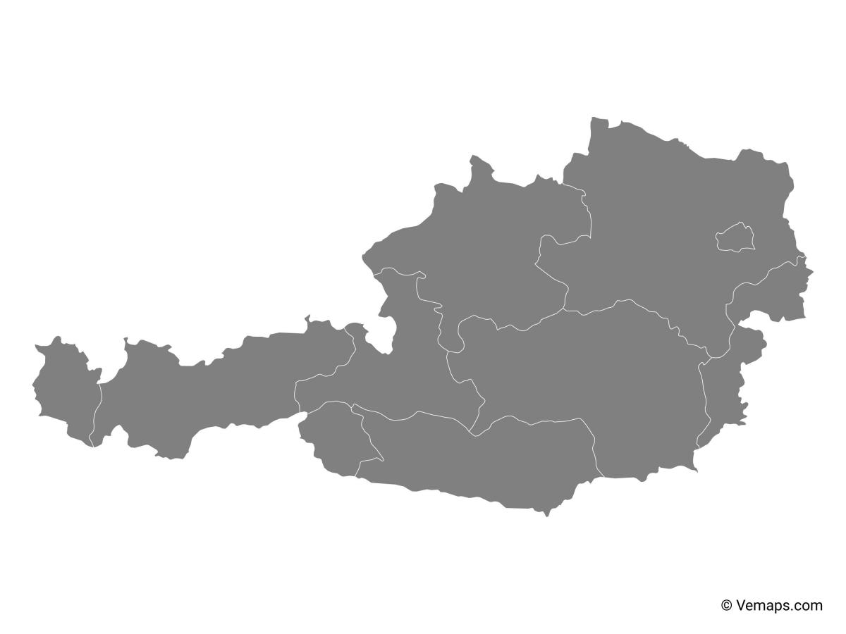
With Austria blank map outline users can learn drawing the accurate map of country from very scratch. This template provides full guidance to the beginners, so that they do not make any mistake in the course of drawing country geography. Users can enhance their geographical knowledge with this Austria map outlines.
Lower Austria, Upper Austria, Vienna, Burgenland, Styria, Salzburg, Tyrol, Vorarlberg, Carinthia, are the major administrative regions into which the country is divided. Vienna, the capital of Austria, plays a double role as city and "Bundesland", meaning that the mayor serves as governor and the city council as Landtag at the same time. The outlines map of Austria gives a clear idea about the political division of the country.
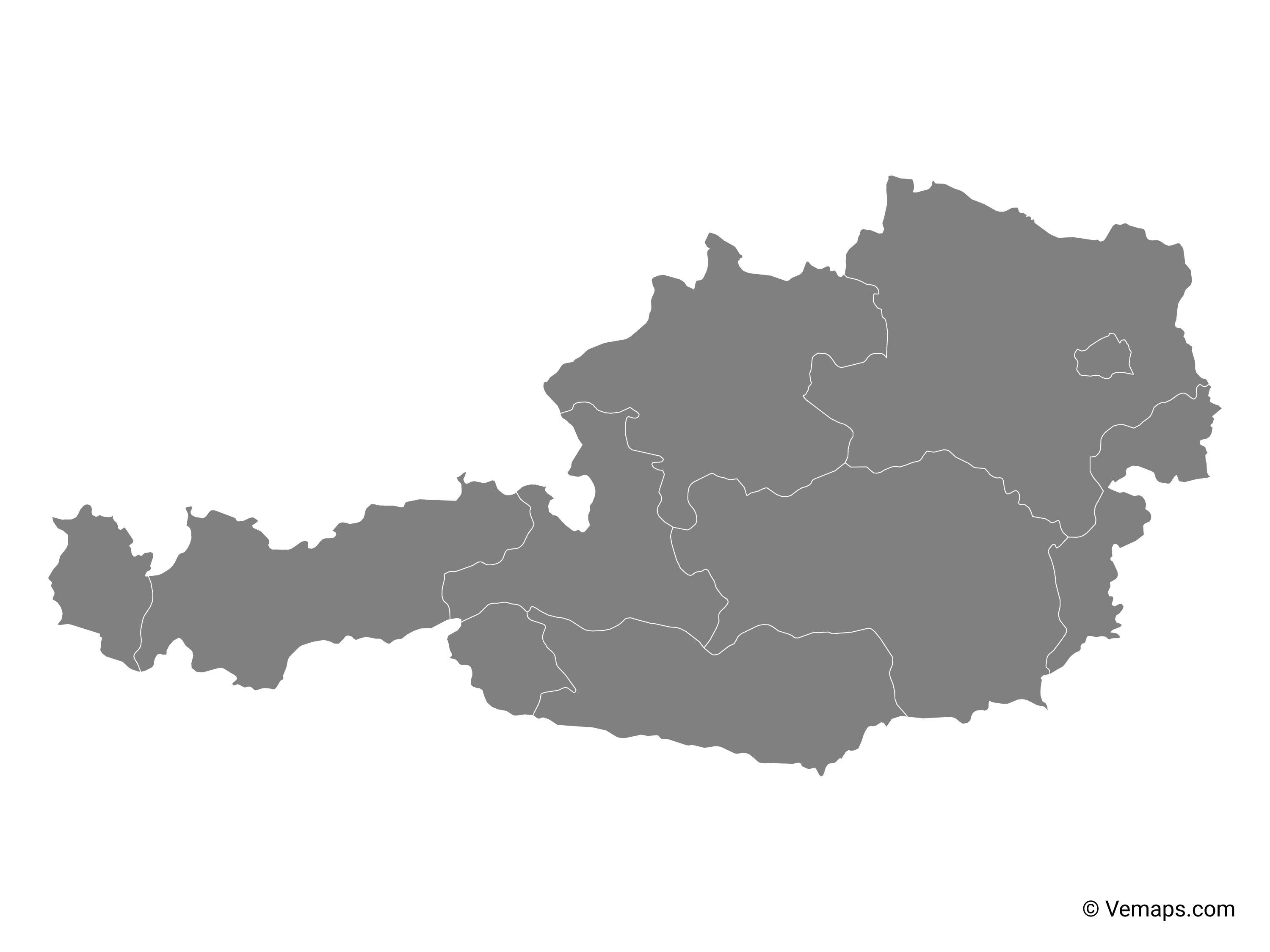
The vector map of Austria shows entire surface of Austria empty. This vector map of Austria will allow you to make changes or add details to the map of Austria in Western Europe, for personal or educational purposes. The vectorial map of Austria is downloadable in PDF, printable and free.
Austria map vector is used by student ad teachers in school for learning purposes, explorers and navigators use it for locating different places of Austria, Tourists use it to shortlist famous places to visit while on their trip to Austria, archeologist use it locate archaeological sites and many other users are there depending in the requirement of the maps and group of people using it.
Largest Cities (pop. 2013) after Vienna as you can see in Austria map vector are: Graz (300,000), Austria second-largest city and the capital of Styria (Steiermark), known as a student city with six universities; Linz (190,000), founded by the Romans, today one of the main economic centers of Austria and the capital of Upper Austria (Oberösterreich), Salzburg (150,000), capital of the federal state of Salzburg, famous for its baroque architecture of the "Old Town" and as the birthplace of composer Wolfgang Amadeus Mozart; Innsbruck (117,000), capital of Tyrol (Tirol) and the cultural and economic center of western Austria, it is an internationally renowned winter sports center; Klagenfurt (90,000), capital of Carinthia (Kärnten), one of the nine Austrian states.
Austria map vector represents the national capital, states along-with the capital cities. Austria map vector also shows the provinces, districts, municipalities, and the other political divisions of the country. The international boundary and state boundaries are presented in the map as well. Vienna, the national capital is clearly shown in the map. It is located in the eastern region of Austria and is often called “The City of Dreams”. The city center has been designated as a UNESCO World Heritage Site. Covering an area of 160.1 square miles and with an estimated population of 1,712,412, Vienna is the largest city in Austria.
